

Nov. 12, 2026
Increasing development in wildfire-prone areas — commonly known as the wildland-urban interface (WUI) — is unlikely to slow down, given the ongoing pressure to build more housing. Recognizing this risk, building those homes with wildfire in mind will strengthen a community’s long-term adaptive capacity and hazard resilience.
Land use planners wield a great deal of power when it comes to reducing community wildfire risk in the WUI. Traditional approaches for development often overlook the critical factors in the built environment that exacerbate wildfire spread through a community, such as closely spaced homes built and maintained the way sprawl always has been, which can transmit fire from structure to structure. But that outcome isn’t fixed. It’s a design and governance choice, and planners are well-positioned to change it. Density without mitigation and planning is risky. Density with mitigation and planning isn’t.

Kimiko Barrett, PhD (left) and Doug Green (right). Photos courtesy of the subjects.
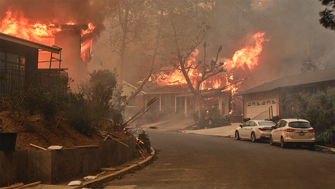
When the Eaton and Palisades fires tore through Los Angeles in January 2025, embers traveled miles ahead of the fire front, igniting homes by landing on rooftops, decks, flammable materials around homes; and penetrating into interior attic spaces via open vents. The same pattern destroyed more than 1,000 homes in suburban Louisville and Superior, Colorado, in the 2021 Marshall Fire, and more than 2,400 homes and businesses in Gatlinburg, Tennessee, in 2016 — a reminder that this isn’t only a California problem, or even a western one. Density alone didn’t cause these losses. Unmanaged ignition pathways did.
The physics of how fire spreads from structure to structure through a community is well-understood — and preventable. Post-fire research points to three predictable pathways: wind-driven embers; radiant heat from one structure to the next; and direct flame contact with combustible decks, fences, and surface fire from burning vegetation. Yet many communities still regulate wildfire indirectly — through hazard maps, suppression, and emergency response — without addressing the materials and spacing that determine whether a home ignites. As a result, new development and post-fire rebuilding often recreate the vulnerabilities that caused the original losses.
That distinction matters for planners, who hold more leverage over those ignition pathways than they realize. Comprehensive plans set where growth happens relative to fire hazard. Zoning and design standards can specify home hardening requirements, defensible space, and how neighborhoods are designed with wildfire in mind. Uniquely, planners can help direct growth in a way that minimizes risk to the community. Early coordination with fire departments — rather than a late-stage sign-off — lets fire-performance criteria shape a project before it’s built, not after it burns.
Kauaʻi County did exactly this in 2025, becoming Hawaiʻi’s first jurisdiction to write wildfire safety into zoning and permitting. Updated codes, developed jointly by the county’s planning department, fire department, and a regional wildfire partner, require ember-resistant roofs and vents, a five-foot noncombustible zone, and managing vegetation out to 100 feet. Parks, greenways, and riparian corridors, planned as maintained buffers rather than incidental open space, add another layer. These serve as interruption points that slow ember and heat transmission into the built environment rather than ignition points.
The ability to regulate the arrangement, layout, proximity, and vegetation management around structures lies almost entirely with housing on the denser end of the spectrum. Multifamily and larger subdivision projects typically go through discretionary review, triggering environmental analysis and fire-agency consultation. Single-family and missing-middle projects, often built one lot at a time and sometimes by right, escape that scrutiny, along with code triggers that apply only above certain unit thresholds.
Planning the Wildland-Urban Interface offers practical guidance and explores a comprehensive approach to planning for the growing threat of wildfire in communities across the United States.
Building back better
“Like-for-like” reconstruction locks in risk and compounds insurance instability. Rebuilding to pre-fire standards doesn’t just fail to reduce risk. It reproduces the same ignition pathways that caused the original losses, block by block, in the same footprint.
The insurance market serves as a price signal for risk on the ground. When standards don’t evolve, and insurers are not convinced that mitigation measures have actually occurred, providers withdraw or raise premiums — not because density exists, but because ignition vulnerabilities do. The problem was never how many homes exist. It’s how they’re built, arranged, and maintained. Like-for-like rebuilding is how that vulnerability gets carried forward instead of corrected — and we now have the data and the incentives to choose differently.
Insurers have already reached this conclusion. Carriers leave fire-prone markets due to unpredictable risk: homes rebuilt with the same vulnerable materials that repeatedly burn. Code-compliant multifamily development gives insurers something sprawl often can’t: consistent, inspectable mitigation of many units at once. That same discipline — verifiable materials, maintained infrastructure, enforced standards — also keeps flood and wind risk insurable elsewhere. Governance that works for one hazard tends to transfer to the next.
None of this happens automatically. It takes planning, building, fire, and public works departments coordinating about how structures ignite, rather than treating wildfire as someone else’s hazard map. Most jurisdictions already have the authority; what’s missing is the alignment.
Housing density, insurance market stability, and wildfire risk reduction are not competing priorities with conflicting solutions. Planners already have the tools to align them: comprehensive plans, zoning, materials standards, fire-agency coordination, and designed buffers. Used deliberately and collectively, these tools don’t force a tradeoff between more housing and less risk. In an era of escalating, faster-moving hazards, good land use planning is a necessity for an effective long-term resilience strategy.
RECOMMENDED ARTICLES