Planning January 2020
The 'Z' Word
Houston is famous for not having zoning. But that doesn’t mean it doesn’t have planning.

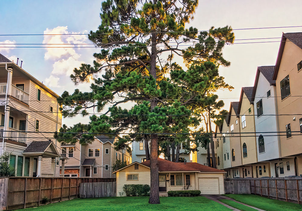
A lone single-family house sits among town houses on Beall Street in Houston. Photo by Adam Clay.
By William Fulton, AICP
I live in a townhome in a rapidly gentrifying neighborhood one mile from downtown in a major American city. It's not cheap, and with good reason: It's within a 10-minute drive of virtually every major job center, sports stadium, entertainment venue, cultural institution, university, and restaurant cluster in the city, as well as a 10-minute walk to the newest Whole Foods in town, located in a recently built mixed-use apartment building.
My townhome is situated on the corner of a busy street. On the other three corners are a law office, a metal fabricating shop, and a nightclub. Coming from California — which has more land-use regulation than anywhere else in the country — this urban jumble was a bit of a shock to me.
Welcome to Houston, the largest city in the country with no zoning.

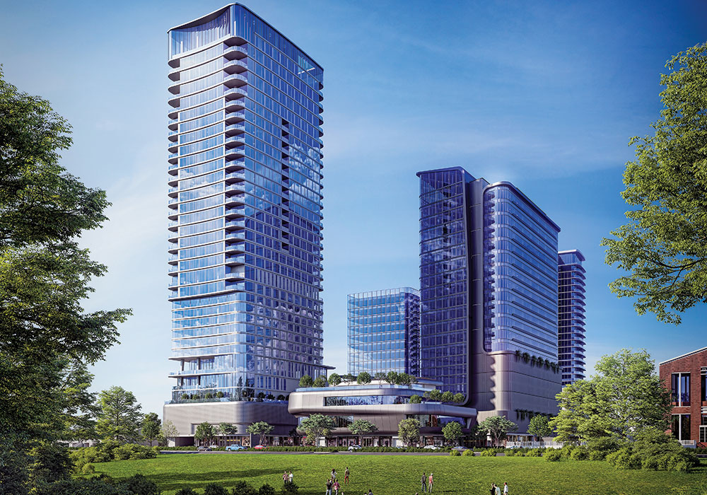
A rendering of The Allen, a mixed-used development along the Allen Parkway. Photo courtesy DC Partners.
Houston is the fourth-largest city in America, with a population of 2.3 million people spread across more than 600 square miles. It contains some of the densest job centers and ritziest residential neighborhoods in the country. Yet three times in the last century — most recently in 1993 — Houstonians have voted down that most elemental of planning policies, zoning based on use. It's the first thing any planner — indeed, almost any person — asks about when they ask about Houston.
A city without zoning, however, isn't necessarily a city without planning. Or without a frustrating development code. Or, in a certain way, even without zoning.
The story of Houston's land-use policies is a lot more complicated than "no zoning." In reality, Houston is a big mixture of ordinances, policies, tactics by neighborhoods, and independent efforts by nonprofits, all of which play a role in determining how land is used. Whether or not the lack of zoning and the use of these other tools add up to a more equitable city or a city where the affluent are protected is open to debate.
The city is rife with plans, strategies, and other efforts to create more walkability, bring new investment into historically underserved communities, and protect the city against future flooding and other hazards. For many years, the region's metropolitan planning organization, the Houston-Galveston Area Council, has conducted Livable Centers studies to show the potential for walkable neighborhoods, while at the same time the city has engaged community leaders and planning commissioners in an effort to create more walkable places. Mayor Sylvester Turner's signature neighborhood effort is Complete Communities, focused on directing city resources to underserved neighborhoods. And most recently, Houston joined the 100 Resilient Cities network, thanks to a grant from Shell, and is crafting plans to improve the city's resilience. (Read more in "Holistic Houston.")
Deep Dive
A Conversation With Houston's Top Planner
At its core, however, Houston's land-use regime boils down to three separate types of efforts.
First are large-scale initiatives to shape the public realm, usually undertaken by philanthropists and civic groups. (Alongside these are some public-sector efforts to create plans around specific topics.) Second are a series of planning tools that act as zoning workarounds, ranging from deed covenants to historic districts. And third is a complicated development code that contains everything you'd expect except use zoning — and, in some cases, density and height restrictions as well — and drives applicants crazy just like the development code in many other cities.
Planning for the public realm
In Houston, the large-scale public realm efforts get the most publicity locally and nationally, and its ambitious greenways planning is no exception. Indeed, the city's approach would not be unfamiliar to Daniel Burnham, whose 1909 Plan of Chicago involved mostly the public realm and was funded not by the city government but by a civic group.
Houston's extraordinary greenway planning along the bayou system appears to be unmatched in any other American city. The city is built around a series of bayous, or sluggish rivers, that flow through its flat lands. More than a century ago, Boston landscape architect Arthur Comey — a protege of Frederick Law Olmsted Jr. — created a parks plan for the city, but implementation ceased during the freeway era. Renewed greenway planning efforts began almost 20 years ago with a plan to restore Buffalo bayou, the most prominent waterway in the city, efforts that recently won a Rudy Bruner Award. A decade ago, the Houston Parks Board — a nonprofit entity — undertook an ambitious plan to create a 150-mile greenway system along all of Houston's bayous by 2020. Now some 1.5 million Houstonians live within 1.5 miles of a bayou greenway.
The plan was financially supported mostly by philanthropists, who committed to raising $120 million of the $220 million required to implement it. Houston voters agreed to provide the remaining $100 million when they passed a bond issue in 2012. The Parks Board has taken the lead in building out the Bayou plan and has worked with philanthropists again to put together a "Beyond The Bayous" greenway plan that seeks to connect the east-west bayous to neighborhoods by using north-south utility easements and other rights-of-way.
The result has been a surprising reorientation of the city away from its famous set of freeway loops, setting the stage for a new round of private development that revolves around the bayous and the greenways. Already these efforts are paying off along Buffalo Bayou, where two large mixed-use developments are being constructed.
Buffalo Bayou Partnership also recently unveiled a plan for the bayou in the less affluent areas east of downtown, where the nonprofit has significant landholdings and plans to initiate efforts for affordable housing and links to historically underserved communities.
No Zoning, But a Few Other Options
DEED RESTRICTIONS: Developers can create land-use restrictions on private land, thereby preventing retail within a residential neighborhood, for instance. The city helps enforce these rules.
DENSITY: Inside the 610 Loop, higher densities have historically been permitted. Recently, those higher density areas have been extended out to Beltway 8.
TAX INCREMENT REINVESTMENT ZONES: This tool allows certain areas within distinct boundaries to retain property tax revenue for uses in that district.
AIRPORTS: Houston adopted airport zoning regulations for the communities around its three airports.
BUFFERING ORDINANCE: New rules restrict tall buildings to "major activity centers" by limiting their height, setback requirements, and construction styles.
HISTORIC PRESERVATION: With enough votes, residents can create a historic district, ensuring certain building restrictions for their neighborhood.
LOT SIZES: The city restricts lot sizes, but a vote by neighborhood residents followed by council approval can reduce lot sizes.
Source: Urban Edge, Kinder Institute for Urban Research
Other tools as workarounds
How all this new development evolves, of course, depends in large part on how Houston manages and regulates private land-use activity. And the land-use system, while unorthodox in many ways, does look surprisingly similar to other cities'.
The biggest difference, of course, is the lack of zoning — but what that really means in Houston is that there is no zoning for use. Under the city's development code, no parcel of land is restricted for any particular land use, and in many cases there are no density or height restrictions either. But what most Houstonians in the know understand is that the city is not entirely without zoning-type regulations.
For example, virtually every affluent residential neighborhood in Houston has strict private deed restrictions — and, remarkably many of those deed restrictions can be enforced by the city. That's why River Oaks, Houston's wealthiest neighborhood, doesn't have apartment buildings or office buildings in the middle of the neighborhood. (They do exist on the perimeter.)
Deed restrictions are not enforced unless complaints are reported, meaning that less affluent neighborhoods often see covenants violated if the residents are not vigilant. Developers are constantly on the lookout for the one parcel in a desirable location that isn't covered by the deed restrictions. This is the loophole that led a few years ago to the well-known "Ashby high-rise" fight, during which affluent residents went to court to fight a proposed high-rise apartment building on Ashby Street near Rice University. A judge ruled the project a public nuisance — meaning the adjacent neighbors had to be compensated but the project could go forward — but developers still have not constructed the building.
Then there are historic districts. Innumerable historic structures have been lost in Houston, whether to termites, floods and winds, or the wrecking ball, but the city has recognized the importance of preserving architecturally important buildings and areas, and landowners may petition for the creation of historic districts or buildings.
The trend began in the early 2000s (there are now 22 total) with the creation of three historic districts in Houston Heights, a bungalow neighborhood northwest of downtown Houston. When the Heights gentrified, it attracted the attention of apartment developers. In response, residents petitioned for the creation of historic districts, which require that the scale and character of the neighborhood remain the same. Some neighborhoods are in effect using historic districts as a zoning substitute.
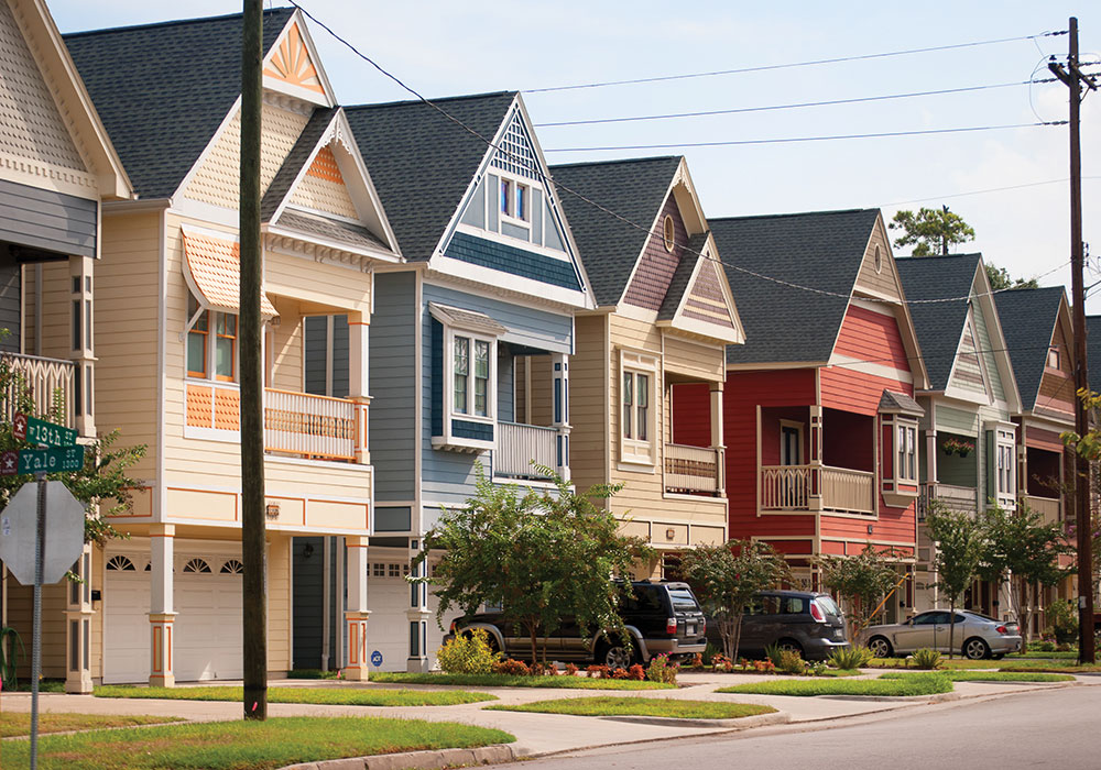
Historic districts aren't the only workarounds. Several years ago, the city also created a process by which neighborhoods could petition for a minimum lot size or building line. In 2001, Houston adopted an ordinance that dramatically decreased minimum lot size inside the Interstate 610 loop, opening up huge chunks of the central city to townhome development. These processes help to eliminate the possibility of townhome development by gathering support from a majority of area property owners and the passage of an ordinance by city council.
Community organizers have heavily promoted the Special Minimum Lot Size technique to protect older neighborhoods with low incomes from the creep of gentrification and displacement. It's been widely used in such neighborhoods, including portions of the traditionally Hispanic East End and traditionally African American neighborhood of Sunnyside. Both have used this Special Minimum Lot Size technique to essentially zone out higher density development. It is also heavily used in more affluent areas, like Houston Heights and the neighborhoods around Rice University.
One could argue that this reduces investment in neighborhoods that need it. However, most of the development in such neighborhoods in Houston comes in the form of expensive townhomes whose cost is far beyond the reach of current residents.

Today's approval process in the historic Houston Heights neighborhood aims to keep larger homes from overwhelming smaller ones. The Heights gets its name from its lofty position above sea level — 62 feet, high ground for a city that is mostly under sea level. Getty Images photo.
Market-driven development
Land deals in Houston were once negotiated between politicians and landowners in the Rice Hotel. Open government laws have long since ended that practice, but the development community continues to influence city regulations.
As for the development code itself, Houston does have one, perhaps contrary to popular belief. It just doesn't have use restrictions and in some cases height and density restrictions. As a result, Joshua Sanders, a local development lobbyist, calls it "a bad form-based code."
The result is a more market-based approach to development, especially in gentrifying neighborhoods. On Montrose Boulevard, for example, two 30-story apartment towers have recently been built in a traditionally one- and two-story neighborhood, adjacent to duplexes and one-story retail and restaurant buildings. The same is true along Main Street in Midtown, alongside Houston METRO's Red Line, one of the busiest light-rail lines in the country.
It also means affordable housing developers have a tough time competing for land, because they are competing against high-rise residential developers and high-end retail and restaurant developers, and whoever else can bring the most money to bear on a parcel.
There are some promising approaches that could make more affordable land and units available, however. The Houston Land Bank was recently reorganized and is now working to reuse tax-delinquent properties it acquires for the public good, including affordable housing. In 2018, the nonprofit Houston Community Land Trust launched, with a mission to build long-term affordable home ownership. (Read more in "Striving for Equity in Post-Disaster Housing," August-September 2019.)
Like the development code in most cities, Houston's code is big, complicated to administer, and in many ways inflexible. In almost all locations in the city, for example, development must provide a 25-foot setback from the street and ample parking requirements. On the other hand, there are no parking requirements in Downtown Houston or in certain parts of Midtown, an adjacent gentrifying neighborhood. Near transit lines, developers are eligible to use an optional transit-oriented development code, but the incentives contained in this ordinance are perceived by developers as modest — a 15-foot setback instead of a 25-foot setback, for example. Most developers in the urban core opt instead to shoot for variances. The city planning commission typically grants setback variances, but not parking variances, leading to gigantic parking garages even in the most urban neighborhoods. (The planning commission's Walkable Places Committee, mentioned above, is looking at ways to beef up the TOD ordinance.)
Despite the lack of traditional zoning and the jumble of other regulations, it's surprising how well Houston works. It's a big, dynamic city that doesn't look or feel that much different from, say, Los Angeles or Dallas. As most other cities are these days, it's a city of haves and have-nots — and the lack of zoning cuts both ways on that issue.
And, with the revival of large-scale public realm planning, especially dealing with greenways, Houston is beginning to gain a strong sense of itself that has always been lacking. Even without zoning, Houston is becoming a better and better urban place every day.
William Fulton, a longtime contributor to Planning, is director of the Kinder Institute for Urban Research at Rice University in Houston. He is the former planning director of San Diego and the former mayor of Ventura, California.
A Conversation With Houston's Top Planner
By Leah Binkovitz

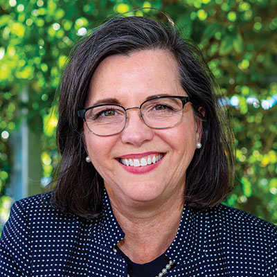
Margaret H. Wallace Brown, AICP, CNU-A
In September, Margaret H. Wallace Brown, AICP, CNU-A, was named director of Houston's Planning and Development Department after more than 30 years with the department. Throughout her long career, Wallace Brown has led or been part of the city's pivotal planning moments, including the creation of the city's first general plan in 2015. Today, she's instrumental in implementing the city's Complete Communities initiative, which helps direct funds and community-driven planning to underserved neighborhoods. And she's overseeing committees that are rethinking everything from parking to housing.
As the sprawling, car-centric city looks to become a multimodal city for all, Wallace Brown says its unconventional approach to planning gives the city the agility it needs to tackle big problems. This interview has been edited for clarity and length.
How would you describe Houston's relationship with zoning and planning?
I think Houstonians, even the leadership, have a love-hate relationship with zoning. We've had multiple referendums about it — none have passed. We are a property-rights city. In the big picture, that works. On the other hand, almost everybody wants to live in a home where they're surrounded by stability and protection from incompatible development. We are always looking for the balance.
That doesn't mean there isn't planning and that we don't have planning tools. We use a combination of platting and performance standards, as well as micro-level ordinances that protect the neighborhoods, like minimum lot size ordinances and historic preservation codes. Those tools offer the ability to zero in on neighborhood needs while still maintaining nimbleness.
What are some of the big challenges for your work?
We've got a robust economy — many of us are doing well. But the reality is that not everybody in Houston enjoys success, and Mayor Sylvester Turner is intentional about bridging that divide. Complete Communities is one way of doing that, as are bike lanes and complete streets. We must provide safe passage for vulnerable users of our roads.
There are a lot of opportunities there, especially as the city tries to improve mobility and housing affordability.
We are nothing if not a city of opportunities to fix past mistakes. Transportation is a big piece of that, considering that our policy for the past decades has been focused on highway capacity. We are now focusing on building up, not out. One example is the work we've done to encourage walkable places. It's a combination of an opt-in type of program for the whole city, while making some of the existing optional transit-oriented development rules mandatory based on the property's proximity to a transit station.
Affordability is a big issue. While the planning department doesn't deal with affordable housing directly, the mayor's mandate is finding ways to make homes more affordable in the little 'a' sense. Part of that is figuring out how to protect existing mixed-income neighborhoods.
How is the city approaching resilience?
The planning department is working closely with Marissa Aho, AICP, the city's chief resilience officer, addressing everything we've been talking about: affordability, minimizing shocks and stresses, maximizing mobility, and helping people find support within their own neighborhood. Someone's connection to their community was one of the things that made a huge difference in their recovery after Harvey.
What can Houston's planning experiences teach other communities?
How to work with diversity, absolutely. As one of the most diverse cities in the country, we are what America is going to be in 20 years.
Our public engagement has changed dramatically because of that. Now we, as a planning department, engage a community that is incredibly diverse, not just ethnically, but in age, passion, language, and any characteristic you can imagine. We do it well. I also think we do a lot with very little.
What makes you excited to get up and go to work in Houston each day?
It's Houston. Who wouldn't want to get up and go to work in this town? This place is an amazing gumbo of people, ideas, passions, and energy. Houstonians are all about taking the opportunity and making something happen. We built the fourth most populous city out of a swamp. I can't wait to see what we can do next.
Leah Binkovitz is a journalist who lives in Houston with her husband and two daughters.


