March 26, 2026
For some, the term "food desert" might conjure up images of shuttered grocery stores and overabundant convenience stores. If you drew a food desert on a map, would its borders be clearly defined? As policies and communities evolve, do local leaders have the insights needed to create equitable food environments?
The Food Equity Access Simulation Technology (FEAST) tool visualizes how different scenarios can affect food access and help answer those questions. Developed at the Kaufman Lab for the Study and Design of Food Systems and Marketplaces at the University of Wisconsin–Madison (UW-Madison), the tool uses artificial intelligence (AI) to predict the effects of store closures, natural disasters, or other changes in a community. By making such predictions, nonprofits and local governments can provide better support to residents who might be disparately affected by these shifts.
Food access has long been a pressing issue in the U.S., but unprecedented policy changes this past year have altered Supplemental Nutrition Assistance Program (SNAP) benefits and shifted government funding for food programs and entrepreneurship. This uncertainty fuels our urgency to better understand policy implications and address gaps to improve food security. Although an open-source tool is not available, FEAST developers invite planners and others to partner in developing local food access projects.
Keeping community first
FEAST was created in collaboration with Intelligent Cyberinfrastructure with Computational Learning in the Environment (ICICLE), among other partners. The project "centers the needs of the community," says Ayaz Hyder, PhD, founder of Ohio State University's Computational Epidemiology Lab, who helped develop FEAST.
The tool was first used in Franklin County, Ohio — home of the state capital, Columbus — where developers mapped the locations of supermarkets, convenience stores, and households using American Community Survey and OpenStreetMap data. The goal was to produce interpretable outputs and transparent information about food access environments that support evidence-based decision-making. Because about half of the Columbus population lives in food deserts, we could demonstrate how FEAST can highlight disparities in places with diverse socioeconomic geography.
The FEAST tool demo highlights Franklin County households in relation to their access to convenience stores and supermarkets.
Homes on the FEAST map are color-coded based on high, fair, or low food access. As users zoom in and out, those homes either cluster or break apart to show different levels of detail. This helps with understanding simulated impacts on a city district, neighborhood, or specific block. The model also projects future changes so a user can understand the impact of a grocery store closure months or years later.
Columbus community leaders and the city government plan to use FEAST for scenario planning to support the Emergency Food Action Plan and Smart Columbus, the area's civic innovation lab.
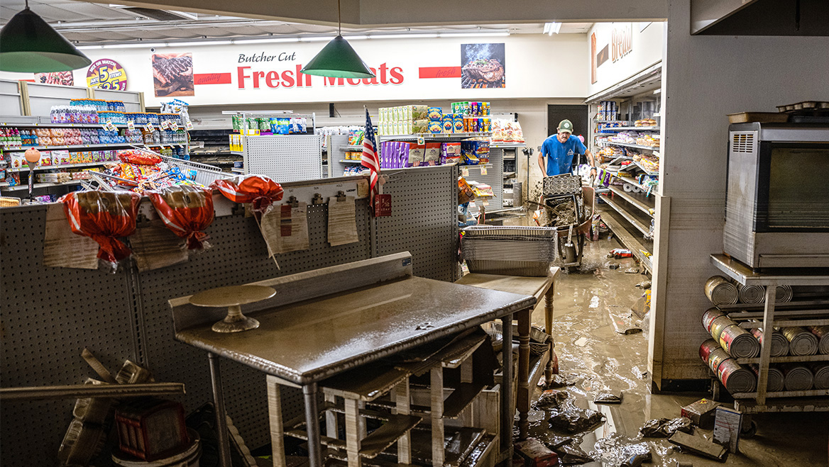
Meanwhile, in Wisconsin, the FEAST team is working with Brown County on disaster preparedness in the Green Bay area. The city's geography makes it prone to flood risk, which can endanger food access, particularly in underserved communities.
The team is customizing FEAST so Brown County can develop scenarios for distributing essential resources during an emergency. The tool juxtaposes community attributes — including income, household size, and vehicle access — with the locations of food sources in the floodplain, allowing FEAST to simulate how closures would disrupt access.
As part of the partnership with Brown County, the team is expanding the tool's classification of various food sources, which adds critical nuance to FEAST. The closure of a food pantry, for instance, would disproportionately affect vulnerable populations.
We also plan to incorporate mobile markets to help nonprofits determine the optimal locations. Ethnic grocery stores will receive their own classification, weighted using demographic data, to demonstrate the importance of access to nutritious and culturally reflective food.
Addressing food insecurity requires thinking about policy and supplemental nutrition assistance just as much as geography, food infrastructure, and urban planning. Our work is driven by our partnerships with the city governments and nonprofits that support the project. Each community is unique, and FEAST can adapt to suit its needs through research and communication.
RECOMMENDED ARTICLES